Factory installed navigation systems are perhaps the most overpriced and underutilized options offered on the luxury car models most of us brokers drive, but using your smartphone to navigate in your car can be clumsy, dangerous, and illegal in some states. If you’re in the market or considering the purchase of a new vehicle, don’t assume that your salesman or dealership understand the systems they sell – they often don’t. Here are some tips to help you traverse the ever changing world of car navigation systems.
- If the vehicle you’re driving is more than 1 year old, assume that you are driving with an outdated navigation system. The maps on factory systems are typically as current as the year of your vehicle – or older. Map updates need to be purchased and installed at the dealership, can be costly, and are usually updated only once a year.
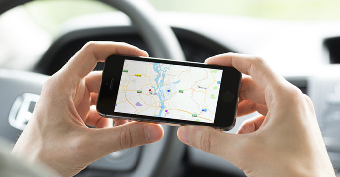
- The most reliable navigation systems are found on your smartphone, with Google Maps and Apple Maps leading the way. Waze, which is quickly becoming the most popular navigation tool (and coincidentally owned by Google) offers users lots of bells and whistles, including traffic conditions, customizable voices, and the social connection to other Wazers (estimated at 85 million monthly users).
- But smartphone apps have their disadvantages. Unless you use a car mount, your smartphone will be sitting in your cup-holder waiting for you to take your eyes off the road to check for directions. Additionally, many states that ban texting while driving consider the use of a mapping application to be just as distracting – and illegal. And then, there’s the battery drain and data usage on long trips.
The good news is that many car companies are beginning to offer both Google Android Auto https://www.android.com/auto and Apple CarPlay https://www.apple.com/ios/carplay/, which provide true integration and real time information. If you’re particular about your mapping system (Google vs. Apple), keep in mind that you’ll be limited to either Google Maps for Google Android Auto and Apple Maps for Apple CarPlay. Waze is now available for use in vehicles equipped with Android Auto.
Other options are available if you’re in the market for a used vehicle or want to update your existing outdated system. After-market in dash systems range in price from $250 to $2,500. The more sophisticated products offer both integration with your smartphone for real time data, as well as built-in maps should you be outside of cell phone range.
- Lastly, portable navigation systems offer a less expensive alternative that can be moved from vehicle to vehicle. Maps can be regularly updated via USB, and with smartphone connections, premium services can be added (live traffic, weather, etc.) Depending on what bells and whistles are important, prices range from $100-$500. https://www.cnet.com/topics/gps/best-gps/
The bottom line:
- Determine what your needs and priorities are. If you don’t need to use your nav system for business or don’t mind sometimes outdated maps, make your decision based on looks, price, or other features (on many vehicles, the nav system is part of the typical upgrade package).
- Before you buy, try out the system. Verify that the maps are current. Bluetooth quality, connectivity speed, compatibility with smartphones, and additional features vary greatly from model to model.